About the park
Murchison Falls National Park: Uganda's largest and oldest
Uganda first protected this landscape in 1926 and made it a national park in 1952. It covers 3,840 square kilometres either side of the Victoria Nile, and it takes its name from the point where the whole river is forced through a gap in the rock narrow enough to jump across.
If you only want the answer
The Nile forces itself through a seven-metre gap here, and everything else about the park radiates from that squeeze. Uganda's biggest and oldest park, wrecked in the war years, recovered since, and now negotiating life with an oilfield.
The falls, and the argument about how wide the gap is
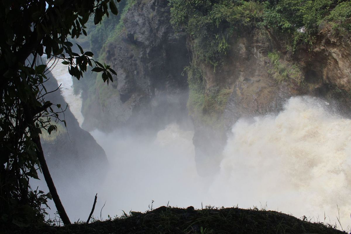
The Victoria Nile has cut backwards through the Rift escarpment, and at the head of Fajao gorge the entire river squeezes through a cleft in the rock and drops 45 metres into the pool below, known as the Devil's Cauldron. The escarpment itself now crosses the landscape about a kilometre downstream of the drop. The height is the one figure UWA states consistently across its plan, its brochure and its website, so use 45 metres and ignore the 43 that circulates online.
The width is a different matter. UWA's General Management Plan puts the cleft at 6 metres. UWA's park brochure says 6 metres, twice. The international Ramsar listing for the site says a rock cleft some 6 metres wide. UWA's current website says 8 metres. Most guidebooks and tour operators say 7. Three independent primary documents attest to 6, which is why we use 6 metres, and why we tell you that UWA's own website disagrees with UWA's own plan.
There is a second waterfall beside it that hardly anyone mentions. Uhuru Falls formed in 1962, the year Uganda became independent, when an exceptionally heavy rainy season split the flow and opened a new channel. Until then the entire river went through the single cleft.
A park cut in half by a river
Murchison sits in north-western Uganda at the northern end of the Albertine Rift, where the Bunyoro escarpment drops into savanna. The Victoria Nile bisects the park from east to west for 80 kilometres, falling 350 metres between Chobe and Paraa before spreading into a delta and entering Lake Albert. The park runs from 619 metres at the lake up to 1,291 metres at Rabongo Hill, which is worth stating because UWA's own park page gives the altitude as 127 metres, and that is simply an error.
The two banks look nothing alike. North of the river is open savanna dotted with borassus palms and acacia woodland, and it holds the Buligi peninsula, the triangle of grassland between the Victoria Nile going in and the Albert Nile coming out. That is the prime game-viewing country. South of the river is bushier and more wooded, with genuine forest patches: Rabongo Forest inside the park, and Kaniyo Pabidi in the adjoining Karuma Wildlife Reserve, both southern outliers of the great Budongo forest.
Paraa, whose name means home of the hippo in Luo, is the tourism hub on the river, and the 525 metre Paraa Bridge there links the two halves of the park. It replaced the old vehicle ferry, which stopped running when the bridge opened to public traffic in early 2022. The park spreads across Masindi, Gulu, Buliisa, Nwoya and Kiryandongo districts. Beyond the national park boundary, the Murchison Falls Conservation Area adds Karuma and Bugungu wildlife reserves for a combined 5,072 square kilometres.
The delta is an internationally listed wetland
The Murchison Falls to Albert Delta wetland system was designated as Ramsar Site 1640 on 15 September 2006, covering 17,293 hectares from the top of the falls down to the confluence with Lake Albert. It is also an Important Bird Area.
The listing singles out shoebill, pelicans, darters and heron species, and records the delta's role as a spawning and breeding ground for the Lake Albert fisheries. It also notes, drily, that conflicts between fishermen and crocodiles are common. For a visitor, the practical meaning is that the delta cruise is not a lesser version of the falls trip but a visit to a separately protected ecosystem.
Uganda's busiest park, with an asterisk
In UWA's last published annual report, covering July 2022 to June 2023, Murchison recorded 145,116 visitors against a national total of 382,285. That makes it comfortably Uganda's most-visited national park, ahead of Queen Elizabeth on 97,814.
Then UWA adds a caveat that almost nothing else on the internet repeats: 38 per cent of that figure, some 54,804 people, were transit clients rather than activity visitors. They were crossing the park on the public road between Masindi or Bulisa and Pakwach or Gulu, not visiting it. Strip them out and genuine tourism visitation was roughly 90,300, which puts Murchison and Queen Elizabeth much closer together than the headline suggests and makes the park feel considerably less crowded than its reputation.
No UWA annual report newer than that has been published. A 2025 ministerial policy statement gives a national figure of 267,623 tourists hosted in wildlife protected areas in FY2024/25, but it is not clear the two numbers are counted on the same basis and there is no park-level breakdown, so we do not present it as evidence of a decline.
The park is quietly changing shape
UWA's State of Wildlife Resources in Uganda 2026 report compares land cover here between 1990 and 2024, and Murchison recorded the largest absolute increase in woodland and forest cover of any protected area assessed, alongside a large decline in grassland and a marked reduction in wetland. UWA attributes it to fire suppression, climate variability and the spread of aggressive species, naming borassus palm and acacia in particular, while conceding that how much of this is invasive and how much is native expansion remains insufficiently quantified.
The authority's own reading is mixed: more trees suit browsers such as giraffe, but the loss of open grassland and wetland raises concerns for grazing herbivores and may disrupt predator and prey dynamics. It also matters for anyone reading survey numbers, because UWA explicitly blames reduced visibility in a greatly invaded park, rather than biological loss, for an apparent dip in giraffe counts.
One clearly positive trend in the same analysis: farmland inside the park declined significantly, which UWA reads as better control of encroachment. By December 2025, 91 kilometres of electric fence had been installed around the conservation area, with 101 km targeted, and UWA reports an estimated 11 per cent reduction in human and wildlife conflict incidents across Murchison and Queen Elizabeth combined between FY2021/22 and FY2022/23.
Oil, in UWA's own words
Petroleum exploration in the Albertine Graben has been under way since 2000, and the graben overlaps a long list of protected areas including this one. Murchison Falls National Park falls partly within Exploration Area Block 1 on the northern bank and Block 2 on the southern bank, and Bugungu Wildlife Reserve falls partly within Block 2.
UWA's own General Management Plan records the concern plainly: exploration was taking place in what it calls the spectacular tourism area of Buligi on the north bank, and in Bugungu Wildlife Reserve. Buligi is the park's main game-viewing circuit, so the overlap between the oil acreage and the core tourist zone is acknowledged by the wildlife authority itself, not only by campaigners. The plan sets a formal objective to contain the negative impacts of petroleum development in the protected area, and notes that inside the Ramsar-listed critical ecosystem zone, oil and gas activities may only be permitted by the Wetland Management Department.
There is an entanglement worth stating too. That management plan was itself financed through the Oil for Development programme, a bilateral agreement between Uganda and Norway, and the planning team included a Warden for Oil Monitoring. UWA's conservation planning for this park has been tied to the oil sector from the outset.
Two caveats on all of this. The plan covered 2012 to 2022 and has expired, and it documents the exploration era rather than the current production era, so it predates the decisions that shaped what is happening on the ground now. And UWA offers a historical footnote that is genuinely interesting: natural oil seeps on the bedrock here were used locally as medicine, and an oil film was visible on the Victoria Nile for centuries before anyone drilled anything.