
Roads, the bridge and the flights
How to get to Murchison Falls National Park
Two things almost every Murchison page online still gets wrong. The ferry across the Nile at Paraa has not run since a bridge replaced it, and the roads in from Masindi are tarmac now, not the murram they were before 2018. Both corrections make this an easier park to reach than its reputation suggests.
If you only want the answer
Drive it: four to five hours from Kampala to the southern gate via Masindi, on tar, and since 2022 a bridge at Paraa has replaced the old ferry. Aerolink flies from Entebbe most of the year for those who want the half day back.
The ferry is gone, and it changes how you plan
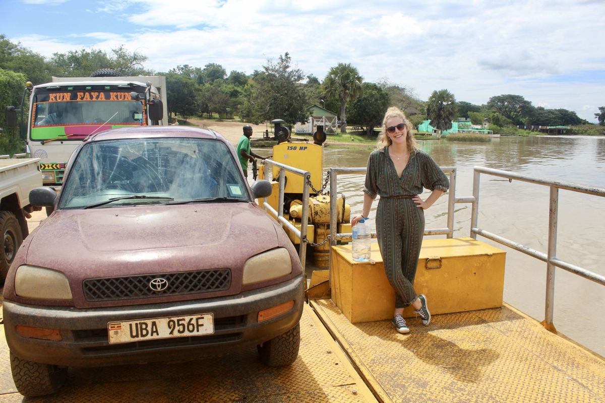
For decades the vehicle ferry at Paraa set the rhythm of a Murchison trip. Everyone planned around the crossing times, the queue and the eight or so vehicles a sailing could take. That service no longer exists. A 525 metre bridge was commissioned in January 2021 and has carried public traffic since early 2022, and UWA itself confirmed in February 2022 that the bridge replaced its ferry service across the river.
So you now drive straight over. The constraints that replace the old ones are the gate hours, 07:00 to 19:00, and the 40 km per hour speed limit inside the park. It also softens the traditional advice against sleeping on the south bank. The prime game circuits and effectively all the giraffe are still on the north side, so a north bank lodge is still the better base, but reaching Buligi from the south is now a drive rather than a wait for a boat.
One loose end we could not close. In August 2022 a newspaper report described two retired ferries kept near the bridge to ease access for passengers on both banks, and nothing published since resolves whether any foot shuttle still runs. Assume you need a vehicle.
By road from Kampala
UWA's own advice is to add one to two hours from whichever gate you use to your lodge, because the park is large and the internal limit is 40 km per hour. The landmark for the turn in Masindi is the Shell garage; the road to Paraa leaves opposite it.
There is no public transport into the park. Buses will get you to Masindi or to Pakwach and no further, so from either town you need a private transfer or a hire vehicle.
| Route | Distance | Gate | Surface and notes |
|---|---|---|---|
| Kampala to the southern gate via Masindi | 305 km, 4 to 5 h | Kichumbanyobo | Tar to Masindi, then paved oil road. Gate is 16 km from Masindi, Paraa about 86 km |
| Masindi to Paraa the scenic way, via Biiso and Bulisa | 136 km | Bugungu or Mubako | Through Budongo forest, then the escarpment descent over Lake Albert. Buliisa to Paraa is paved |
| Kampala to the northern gates via Karuma and Pakwach | 260 km to Karuma | Chobe, Wankwar or Tangi | Kampala to Gulu highway, then paved into the park. Best if you are coming from or going to Gulu and Kidepo |
| Fort Portal to the southern gates | 280 km, 6 h or more | Kichumbanyobo | For circuits linking Kibale and Queen Elizabeth |
The murram warning is out of date
The corridor running Masindi to Park Junction to Tangi Junction to Paraa and on to Buliisa was rebuilt in bitumen under a contract awarded in 2018 and worth roughly 219 million dollars, financed by Exim Bank and the Ugandan government. The paved sections include Kisanja to Park Junction at 72 km, Buliisa to Paraa at 38 km, Wangkwar to Paraa at 37 km, Paraa to Pakwach at 24 km and the 12 km spur from Sambiya to the falls.
The effect is dramatic. The escarpment drop from the Pakuba airstrip down to Paraa, once the section people dreaded, is now a smooth curve, and Masindi town to the Tangi gate takes about an hour and a half across the bridge where it used to eat most of a day.
Why does every guide still say murram? Because UWA's own park page and its printed brochure have not been updated and still describe the old surface, and everyone copies UWA. What has not changed is the game-viewing tracks themselves. Those are still earth, they still cut up in the rains, and that is where you need the 4x4.
Which gate you want
- Kichumbanyobo, 16 km from Masindi, is the tourist gate on the southern approach and passes Kaniyo Pabidi on the way. UWA reserves it for visitors rather than through traffic.
- Bugungu and Mubako sit at the western end of the southern approach, reached by the longer route through Biiso and Bulisa. Mubako is the one to aim for if you are staying in the lodge cluster just outside the western boundary.
- Chobe, Wankwar and Tangi are the northern gates, all off the Kampala to Pakwach road. Tangi is the useful one for the lodges along the Albert Nile near Pakwach.
- Every gate keeps the same hours, 07:00 to 19:00, and your entry ticket runs for 24 hours from the moment you enter.
Karuma Bridge, and why 2027 may look different
The Kampala to Gulu highway crosses the Nile at Karuma, in the park's north-eastern corner, on a bridge built in 1963. When that bridge closes, national highway traffic is diverted through the national park, which is why 38 per cent of Murchison's recorded visitors are transit clients rather than tourists.
The recent history is messy. Karuma closed to heavy vehicles in May 2024, then to everything in September 2024 after engineers found faults in the deck and bearings, reopened to light traffic in December 2024, shut again for three weeks in spring 2025 and reopened on 14 April 2025. It is open now. But on 10 July 2026 Uganda signed a contract with Zenitaka Corporation to build a replacement, with works starting in October 2026.
Plan accordingly. If you are travelling from late 2026 onwards, expect lorries and buses to be routed through the park again on the Tangi to Bugungu axis, and check UWA's transit notices before you commit to a date.
One thing not to repeat: during the 2024 full closure UWA waived the entry fee for vehicles transiting between Tangi and Bugungu. That waiver expired on 31 December 2024 and is no longer in force.
Flying in
Aerolink Uganda is the scheduled operator, flying Cessna Grand Caravans from the passenger terminal at Entebbe International Airport. Murchison is one of the six destinations on its network, and the park has three airstrips: Pakuba on the north bank for the Paraa cluster, Bugungu on the south bank for most of the lodges west of Paraa, and Chobe at the eastern end beside the lodge of the same name.
Two details from Aerolink's own 2026 timetable. There is no scheduled service at all in March, April, May and November, so those four months need a charter. And the flight runs only with a minimum of four passengers per airstrip, which means a couple travelling alone has no guarantee it will operate.
The 14:20 departure out of Murchison connects onward to Kasese for Kibale and Queen Elizabeth, and to Kihihi for Bwindi, which is what makes the park work as one leg of a fly-in circuit. Aerolink only guarantees connections inside its own network. A Jinja to Murchison leg is available on request at a surcharge of 1,000 dollars.
No operator publishes fares for this route, so we are not going to invent one. Charters go from Entebbe or from Kajjansi airfield near Kampala; Bar Aviation flies out of Kajjansi and lists no scheduled safari services or prices.
| Flight | From | To | Depart | Arrive |
|---|---|---|---|---|
| A8 121 | Entebbe | Murchison (Pakuba, Chobe or Bugungu) | 13:00 | 14:00 |
| A8 122 | Murchison | Entebbe | 14:20 | 17:15 |
| A8 121 | Pakuba, Chobe or Bugungu | Kasese or Kihihi | 14:20 | 15:30 |
Baggage, check-in and landing fees
- Aerolink allows 15 kg in total per passenger, in soft bags, and that figure includes your hand luggage. Checked bags should be no more than 60 by 45 by 33 cm.
- Excess is charged at 5 dollars per kilo and carriage is at the airline's discretion. If you must carry more, you can buy a guaranteed 75 kg of freight space at the child fare rate.
- Check in 60 minutes before departure at Entebbe and 30 minutes at any bush airstrip. Children aged two to eleven pay 70 per cent of the adult fare.
- UWA charges the aircraft a landing fee as well: 20 dollars for up to three seats, 30 for four to six, 40 for seven to fourteen, 50 for fifteen to twenty, 60 above that and 125 for a helicopter. Parking is UGX 10,000 a day. Passengers still pay park entry on top.
- Pakuba has a 1,760 metre murram runway and is about 19 km from North Paraa by road. Bugungu is gravel at 1,541 metres. Chobe is roughly 1,555 metres, a figure we could only find on Wikipedia.
Self-driving and the fee that catches people out
- Self-driving is allowed and reasonably common in Uganda. UWA prices it separately: a self-guided game drive is 10 dollars per vehicle, against 25 dollars per guide if you take one.
- The biggest money decision you will make here has nothing to do with lodges. A foreign-registered 4x4 pays 150 dollars a day in vehicle entry plus Murchison's own 10 dollar surcharge, so 160 dollars. A Ugandan-registered 4x4 pays UGX 30,000 plus UGX 10,000, which is about 11 dollars. Renting locally costs roughly one fifteenth of driving your own vehicle in.
- That Murchison surcharge is easy to miss and applies nowhere else. It replaced what used to be the ferry levy and is still charged now the bridge has taken over.
- You need a 4x4 for the game tracks, and you will want one on the approach roads during the rains in April and May and again in October and November.
- Driving off the tracks is treated as a serious offence: 150 dollars per person in the vehicle, billed to the driver. Killing an animal on the road costs 500 dollars. Sounding your horn or littering costs UGX 100,000 each, and sitting on the roof costs 100 dollars.
- Motorcycles are prohibited in the park. Night game drives need a UWA guide and are limited to guests sleeping inside the boundary.
- Keep every receipt. Rangers check them, and defaulting on a tariff carries a 150 dollar charge per person.
Fuel
Arrive with a full tank. There is a fuel point marked at North Paraa near the UWA headquarters on open mapping data, but we could not confirm that it sells to the public or that it is reliably stocked, and no lodge or UWA page mentions it.
The stations we can vouch for are in Masindi, which is the last dependable fill on the southern approach and roughly 85 to 105 km short of Paraa; at Buliisa and Kisiabi on the Hoima road if you are coming the western way; at Pakwach about 25 km north of Paraa; at Olwiyo and Anaka on the northern approach; and in the cluster at Kigumba on the Kampala to Gulu highway.
Something this page does not answer?
Routes and road conditions change faster than any page can. If yours does not fit what is written here, ask.
Ask us. We answer questions about the park itself, and we can usually tell you which camps work on one route and who to write to. If what you want is a trip someone else arranges, we will say so and hand you to an operator we know, and we earn a commission if that becomes a booking.
Nothing on this site sits behind the form. Every figure we have is already on the page.